
💡 Read our blog to learn more about what a digital twin is exactly and what it can be used for.
The digital twin contains a lot of different types of data:
Structured data: solar panel serial numbers, thermal anomaly classifications, etc.
Geospatial data: 2D & 3D drone data, satellite data, CAD drawings, etc.
File-based data: IV curve measurements, building designs, images, etc.
In this article, we focus on the different ways to incorporate file-based data in the digital twin.
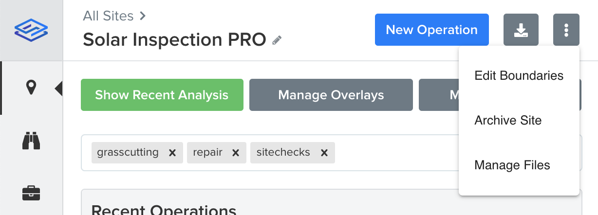
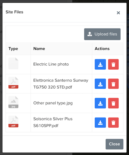
Site Files
Site files can be accessed on the site detail page under the more button (Manage Files). It allows you to store files for a specific site. It's useful for module specifications, site access documents, etc.
Operation Files
Similar to site files, you can also store files on a specific operation. You can access the operation files through the Files button of an operation. This is useful for third party inspection reports, health and safety documentation, etc.
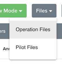
Pilot Files
Similar to operation files, there's a special files section for pilots. This can be used for contracts, permission documents, flight logs, etc.
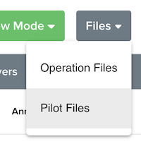
Photo Annotations
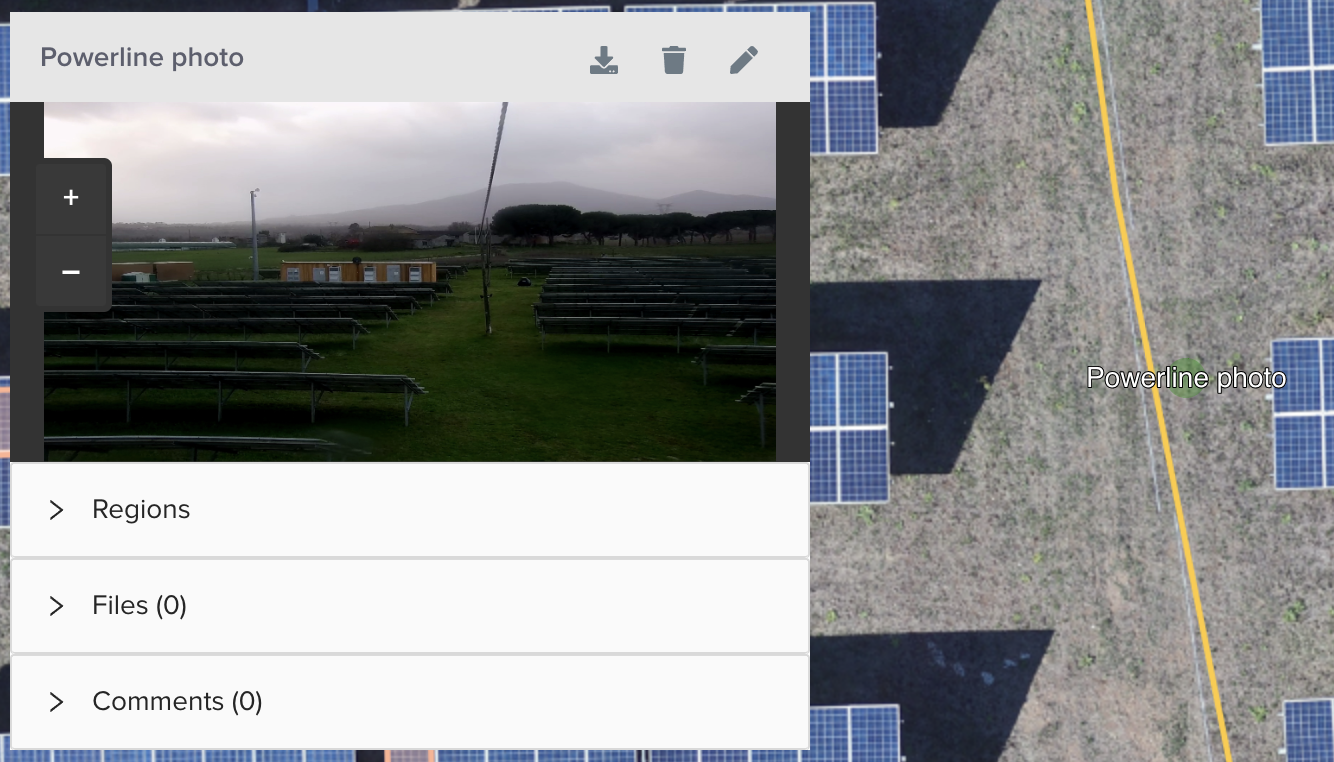
Photo annotations allow you to upload photos with geospatial information embedded in them. If you or the pilot have captured additional images on site during the operation using a smartphone or drone, you can upload these as a photo annotation. The images will automatically be placed on the right spot.
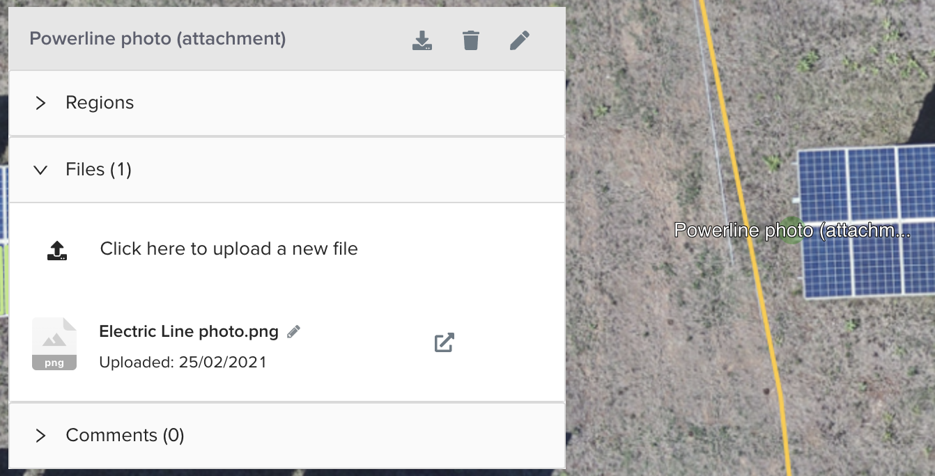
Annotation / Anomaly Attachments
If you want to link files to a specific element on site, you can use the attachments feature. Any annotation you create and anomaly / element we detect supports file attachments. Just open the Files section and upload the files you want to add. It can be used for photos that don't have locations in them, IV curve measurements, additional photos gathered in the field, 3D models, etc.