
Solar Construction Statistics Mode
Customers who already worked with the Solar Inspection products are familiar with the Statistics Mode of an operation. It presents you useful insights into the data of that operation in the form of charts.
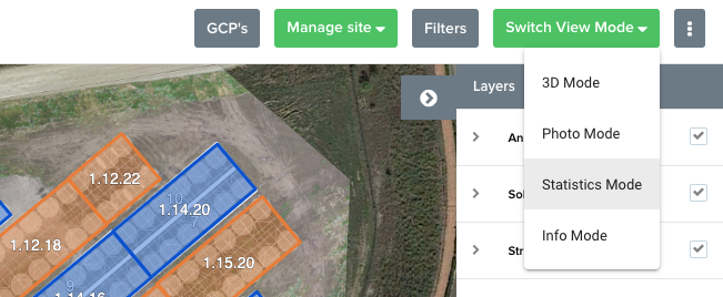
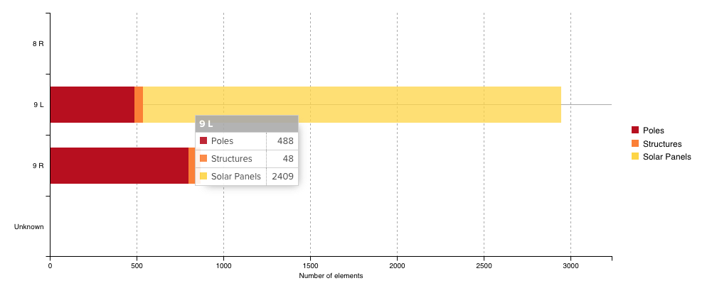
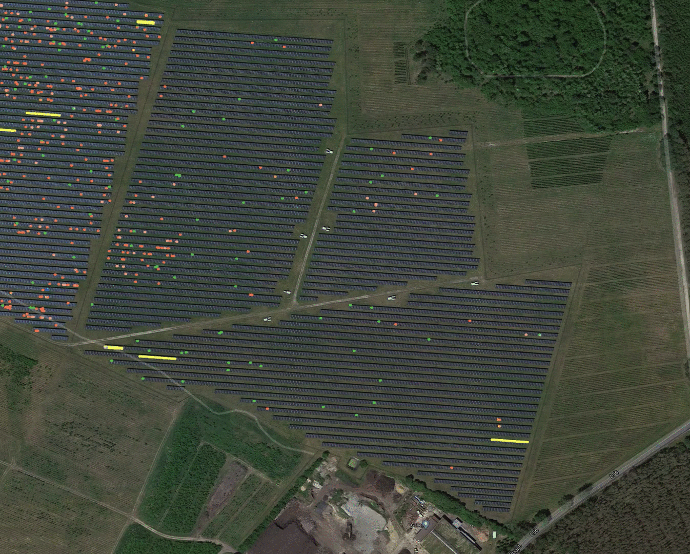
This release adds that functionality to the Solar Construction product. You can now get a detailed count of the different types of elements that were detected on a solar construction site. This analysis is helping you to follow-up on the progress of your solar construction project.
💡 In the next two weeks we'll work on adding site-level statistics as well. They'll allow you to get a quick overview of the construction progress on the entire site.
Optimised PDF Overlays
We'll now automatically optimise every PDF overlay after upload to make it load faster on the map. You'll notice the Optimising and Optimised tags in the overlay overview:

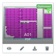
A few extra notes:
It can take between a few minutes and a few hours to optimise the PDF, depending on the size of the area it covers.
You can't edit the PDF as long as it's optimising. You can always delete it however, in case you made a mistake you want to fix quickly.
PDFs you already uploaded to the platform won't be optimised. You can upload it again or slightly move one of the geo-referencing points to trigger the optimisation.
The following .gif shows you the benefit of adding an overlay to your site on SIDEREAL Fuse platform. You will get a better overview and more insights of your data.
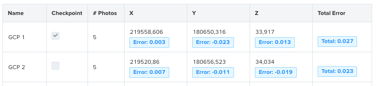
Ground Control Checkpoints
We now offer support for using ground control checkpoints. These are points that are not taken into account during processing and can thus be used to evaluate the accuracy of the results of an operation.
⚠️ Note that checkpoints also have to be tagged in several photos, otherwise the system won't be able to validate the accuracy.